Home -
  • Ko Wai Mātou. About
    • Future Development Strategy
    • Wellington Regional Growth Framework
  • A Mātou Mahi. Our Projects
    • Aggregate Opportunity Sites Study
    • Iwi Capacity and Capability Project
    • Levin-Taitoko Structure Plan
    • Priority Development Areas
    • Regional Adaptation Project
    • Regional Economic Development Plan 2022-2032
    • Regional Emissions Reduction Plan 2024-2030
    • Regional Food System Plan
    • Regional Housing Action Plan
    • Regional Industrial Land Study
    • Urban Design Toolkit
    • Wellington Transport Emissions Reduction Pathway
  • Pūrongorongo. Reports and papers
  • Regional Data Dashboard
  • Whakapā Mai. Contact Us
Home -
    • Ko Wai Mātou/ About
    • Future Development Strategy
    • Wellington Regional Growth Framework
    • A Mātou Mahi/ Our Projects
    • Aggregate Opportunity Sites Study
    • Iwi Capacity and Capability Project
    • Levin-Taitoko Structure Plan
    • Priority Development Areas
    • Regional Adaptation Project
    • Regional Economic Development Plan 2022-2032
    • Regional Emissions Reduction Plan 2024-2030
    • Regional Food System Plan
    • Regional Housing Action Plan
    • Regional Industrial Land Study
    • Urban Design Toolkit
    • Wellington Transport Emissions Reduction Pathway
  • Pūrongorongo Reports and papers
  • Regional Data Dashboard
  • Whakapā Mai Contact Us
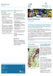
  • Pinehaven Flood Hazard Information Sheet and Map 7 preview

    Pinehaven Flood Hazard Information Sheet and Map 7

    This information sheet covers the current flood hazard extent for the Pinehaven Stream Catchment that was identified in Phase 1 of the joint Upper Hutt City Council and Greater Wellington…

    Pinehaven Flood Hazard Information Sheet and Map 7 preview

    Download now (PDF 526 KB)

    alarm Published 01 Jun 2010
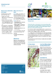
  • Pinehaven Flood Hazard Information Sheet and Map 8 preview

    Pinehaven Flood Hazard Information Sheet and Map 8

    This information sheet covers the current flood hazard extent for the Pinehaven Stream Catchment that was identified in Phase 1 of the joint Upper Hutt City Council and Greater Wellington…

    Pinehaven Flood Hazard Information Sheet and Map 8 preview

    Download now (PDF 512 KB)

    alarm Published 01 Jun 2010
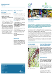
  • Pinehaven Flood Hazard Information Sheet and Map 4 preview

    Pinehaven Flood Hazard Information Sheet and Map 4

    This information sheet covers the current flood hazard extent for the Pinehaven Stream Catchment that was identified in Phase 1 of the joint Upper Hutt City Council and Greater Wellington…

    Pinehaven Flood Hazard Information Sheet and Map 4 preview

    Download now (PDF 512 KB)

    alarm Published 01 Jun 2010
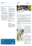
  • Pinehaven Flood Hazard Information Sheet and Map 1 preview

    Pinehaven Flood Hazard Information Sheet and Map 1

    This information sheet covers the current flood hazard extent for the Pinehaven Stream Catchment that was identified in Phase 1 of the joint Upper Hutt City Council and Greater Wellington…

    Pinehaven Flood Hazard Information Sheet and Map 1 preview

    Download now (PDF 484 KB)

    alarm Published 01 Jun 2010
  • Pinehaven Flood Hazard Information Sheet and Map 5 preview

    Pinehaven Flood Hazard Information Sheet and Map 5

    This information sheet covers the current flood hazard extent for the Pinehaven Stream Catchment that was identified in Phase 1 of the joint Upper Hutt City Council and Greater Wellington…

    Pinehaven Flood Hazard Information Sheet and Map 5 preview

    Download now (PDF 512 KB)

    alarm Published 01 Jun 2010
  • Pinehaven Flood Hazard Information Sheet and Map 8 preview

    Pinehaven Flood Hazard Information Sheet and Map 8

    This information sheet covers the current flood hazard extent for the Pinehaven Stream Catchment that was identified in Phase 1 of the joint Upper Hutt City Council and Greater Wellington…

    Pinehaven Flood Hazard Information Sheet and Map 8 preview

    Download now (PDF 493 KB)

    alarm Published 01 Jun 2010
  • Pinehaven Flood Hazard Information Sheet and Map 2 preview

    Pinehaven Flood Hazard Information Sheet and Map 2

    his information sheet covers the current flood hazard extent for the Pinehaven Stream Catchment that was identified in Phase 1 of the joint Upper Hutt City Council and Greater Wellington…

    Pinehaven Flood Hazard Information Sheet and Map 2 preview

    Download now (PDF 512 KB)

    alarm Published 01 Jun 2010
  • Decisions Report: proposed Regional Policy Statement for the Wellington Region 2010, Volume 2 preview

    Decisions Report: proposed Regional Policy Statement for the Wellington Region 2010, Volume 2

    Includes decisions on submissions on the proposed Regional Policy Statement from policy 20 to end

    Decisions Report: proposed Regional Policy Statement for the Wellington Region 2010, Volume 2 preview

    Download now (PDF 667 KB)

    alarm Published 31 May 2010
  • Proposed Regional Policy Statement for the Wellington region May 2010  preview

    Proposed Regional Policy Statement for the Wellington region May 2010

    “Decision version” of proposed Regional Policy Statement (2010)

    Proposed Regional Policy Statement for the Wellington region May 2010  preview

    Download now (PDF 1.1 MB)

    alarm Published 31 May 2010
  • 2010-05-18_09-30_4_Agenda.pdf

    Download now (PDF 14 KB)

    alarm Published 28 May 2010
  • Prev
  • 1
  • ...
  • 132
  • 133
  • 134
  • 135
  • 136
  • ...
  • 1518
  • Next
Archive - Library
  • September 2025
  • August 2025
  • July 2025
  • June 2025
  • May 2025
  • April 2025
  • March 2025
  • February 2025
  • January 2025
  • 2024 - 2015
  • 2014 - 2005
  • 2004 - 1995
  • 1994 - 1970

Kāinga 

  • Ko Wai Mātou
  • A Mātou Mahi
  • Pūrongorongo
  • Whakapā Mai

Home 

  • About
  • Our Projects
  • Reports
  • Regional Data Dashboard
  • Contact Us

Misc 

  • Get in touch
  • Privacy policy
  • Terms & conditions
Greater Wellington Regional Council Logo, Te Pane Matua Taiao
Copyright © 2025 Greater Wellington Regional Council
New Zealand Government Logo